Log in
All resources
Create a design
11,720 Free Images of 1876 Map Sheets
oil on canvas
bibliothèque nationale de france
unknown
map of bruges by marcus gheeraerts (i)
marcus gheeraerts the elder
1876 landscape paintings from denmark
drawings in the groeningemuseum
etching print
groeningemuseum
géographie générale; physique, politique et économique (1876)
art of the united states
albert fitch bellows
post-impressionism,pont-aven school,symbolism,synthetism,cloisonnism,impressionism,primitivism
paintings of peonies
19th-century portrait paintings in the nasjonalmuseet for kunst, arkitektur og design
paintings by adolph tidemand in the nasjonalmuseet for kunst, arkitektur og design
photographs by george washington wilson in aagm
george washington wilson
map of paris by truschet and hoyau - derivatives files
église saint-sulpice on old maps
coats of arms of sweden and poland (personal union)
details of sigismund's map of moscow
turgot map of paris, kyoto university library – derivative files
chapelle saint-éloi (paris)
contact sheets by the ford white house (september 1976)
raimondo manzini (diplomat)
the geographical distribution of animals (book)
maps of ecozones
19th-century maps of sumatra
mount ophir
sailing ships of the united states
émile frédéric nicolle
chaetoceros laevisporus
illustrations
chaetoceros wighamii
illustrations
19th-century maps of somalia
1876 maps of africa
fur clothing of chukchi people
fur fashion in 1876
reconstructions of old maps
german renaissance
reconstructions of old maps
german renaissance
jodocus hondius ii, nova totius terrarum orbis geographica ac hydrographica tabula, 1636
eran laor cartographic collection
hendrik van langren map of south asia
1590s maps of the levant
maps in the rijksmuseum amsterdam
johannes blaeu - map of antwerp
1890s maps of ethiopia
fra mauro map details
prints in the stadsarchief amsterdam
map of amsterdam, 1544
david rumsey historical map collection
maps of rügen by eilhard lubinus
atlas des anciens plans de paris by imprimerie nationale, 1880 from bhvp
dheulland map of paris
curt teich postcard archives
map postcards
atlas des anciens plans de paris by imprimerie nationale, 1880 from bhvp
dheulland map of paris
le monde illustré
1876 in france
1876 oil on canvas paintings
paintings by peter kornbeck
1876 landscape paintings from denmark
paintings by frederik rohde
1876 landscape paintings from denmark
paintings by peter raadsig
paintings by jack spurling
piako (ship, 1876)
miniature sheets of hungary
john milton
map of the circle of upper saxony by sanson
1700s maps of saxony
john rocque's 1748 map of london and adjacent country
remigius parr
map of modern syria by philippe de la rué
bibliothèque nationale de france
john rocque's 1748 map of london and adjacent country
remigius parr
map of europe by nicolas and guillaume sanson (1669)
1680s maps of europe
map of modern syria by philippe de la rué
bibliothèque nationale de france
map of modern syria by philippe de la rué
bibliothèque nationale de france
1650s maps of the world
age of discovery
truscott map of st-petersburg 1753
engraved maps of saint petersburg
map of bruges by marcus gheeraerts (i)
drawings in the groeningemuseum
turgot map of paris, kyoto university library – derivative files
église saint-sulpice on old maps
map of bruges by marcus gheeraerts (i)
drawings in the groeningemuseum
turgot map of paris, kyoto university library – derivative files
foire saint-laurent
map of bruges by marcus gheeraerts (i)
drawings in the groeningemuseum
map of bruges by marcus gheeraerts (i)
drawings in the groeningemuseum
map of bruges by marcus gheeraerts (i)
drawings in the groeningemuseum
map of bruges by marcus gheeraerts (i)
drawings in the groeningemuseum
map of bruges by marcus gheeraerts (i)
drawings in the groeningemuseum
maps of paris from bibliothèque nationale de france
ludovic baschet
turgot map of paris, kyoto university library – derivative files
plans of the musée rodin
18th-century maps of crimea
1780s maps of ukraine
1876 landscape paintings from denmark
paintings by christian zacho
paintings by frederik christian kiærskou
1876 landscape paintings from denmark
nouvelle géographie universelle, vol. xii
charles eugène perron
photographs by paul wolff (1876-1947) from the deutsche fotothek
mohr mit smaragdstufe
paintings by frederik christian kiærskou
1876 landscape paintings from denmark
engravings by zsigmond pollák
jenő jendrassik
paintings of ships by antonio jacobsen
ships built in 1876
photographs by paul wolff (1876-1947) from the deutsche fotothek
mephisto und faust
sadko (repin)
realism
photographs by maurits verveer
huygenshuis
frank leslie's illustrated historical register of the centennial exposition, 1876
great industrial exhibition (1853)
nouvelle géographie universelle, vol. xii
charles eugène perron
photographs by paul wolff (1876-1947) from the deutsche fotothek
mohr mit smaragdstufe
nouvelle géographie universelle, vol. xii
charles eugène perron
the quiver of love. a collection of valentines ancient and modern (1876)
symbolism
nouvelle géographie universelle, vol. xii
charles eugène perron
1876 landscape paintings from germany
paul von franken
1876 landscape paintings from denmark
paintings by n. h. christiansen
prints in the missouri history museum
stragglers
1876 landscape paintings from denmark
paintings by n. h. christiansen
photographs by étienne carjat
photographs of victor hugo
paintings by helmuth dirckinck-holmfeld
1876 paintings from denmark
prints in the missouri history museum
edwin forbes
1876 paintings by gustave courbet
realism
géographie générale; physique, politique et économique (1876)
old maps of the western hemisphere
the masterpieces of the centennial international exhibition of 1876
pont-aven school
brehms tierleben. allgemeine kunde des tierreichs (1876)
gustav mützel - mammal illustrations
géographie générale; physique, politique et économique (1876)
19th-century maps of southeast asia
brehms tierleben. allgemeine kunde des tierreichs (1876)
gustav mützel - mammal illustrations
cuninghame, topographized by timothy pont (1876)
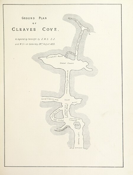
maps of caves in the united kingdom
géographie générale; physique, politique et économique (1876)
19th-century maps of hautes-pyrénées
géographie générale; physique, politique et économique (1876)
old maps of the amazon river
the masterpieces of the centennial international exhibition of 1876
pont-aven school
portrait paintings by eilif peterssen
portraits of eilif peterssen
department of american paintings and sculpture, metropolitan museum of art
1876 drawings
department of american paintings and sculpture, metropolitan museum of art
1876 drawings
turgot map of paris – derivative files
maison du temple (paris)
paintings of women by mary cassatt
impressionism
art in the national library of new zealand
ornithological miscellany (1876 book)
william lionel wyllie
1891 in art
harper's weekly illustrations by thomas nast
harper's weekly, 1877
paintings by frederik collett in the nasjonalmuseet for kunst, arkitektur og design
19th-century genre paintings in the nasjonalmuseet for kunst, arkitektur og design
paintings of women by pierre-auguste renoir
impressionism
map of bruges by marcus gheeraerts (i)
old maps of sluis
history of greenwich (district of london)
john rocque 1746 london map (a1-h3)
the annals of the voyages of the brothers zeno (1898)
fra mauro map derivative works
maps of the ottoman empire by mercator-hondius
eran laor cartographic collection
5501 - 5600 of 11,720
Next page
/ 118


![[Reproduction of the terrestrial globe (orbis imago) by Jean Stabius, 1515] (Facsimile reproduction)](https://cdn.creazilla.com/illustrations/10000450806/reproduction-of-the-terrestrial-globe-orbis-imago-by-jean-stabius-1515-facsimile-reproduction-sm.jpg)
![[Reproduction of the terrestrial globe (orbis imago) by Jean Stabius, 1515] (Facsimile reproduction)](https://cdn.creazilla.com/illustrations/10000781714/reproduction-of-the-terrestrial-globe-orbis-imago-by-jean-stabius-1515-facsimile-reproduction-sm.webp)